

May 4, 2021 – Arvizio, a provider of augmented reality (AR) solutions for real time collaboration and visualization, has today announced the ability to incorporate drone and UAV mapped 3D models and point clouds into multi-user, multi-location AR collaborative sessions using its Immerse 3D solution. According to Arvizio, its customers will now be able to visualize and interact with 3D aerial photogrammetry and/or LiDAR scans in engineering projects for fields such as construction, precision agriculture, infrastructure, mining, utilities and energy.
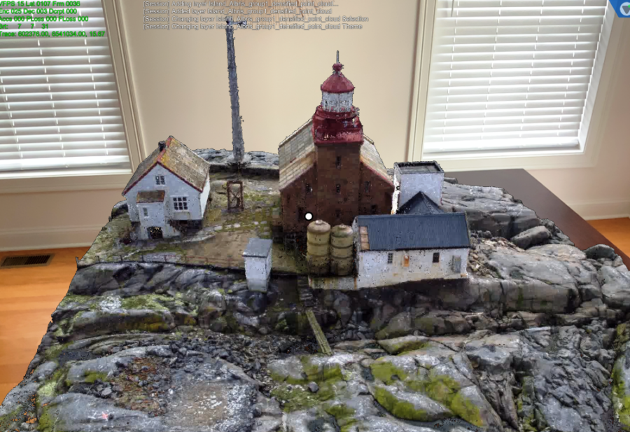
Many enterprises and public works are now utilizing drone 3D mapping for project planning, progress tracking and assessing short- and long-term changes. Arvizio noted that these datasets produced by photogrammetry or LiDAR are large and can be difficult to visualize on AR headsets, iPad or Android tablets and iPhone and Android mobile devices. Therefore, Arvizio’s Immerse 3D platform offers wide area network streaming and dynamic level of detail processing for these massive datasets.
Customers can now leverage the GPU power of a PC, server or cloud-based virtual machine to stream industrial scale 3D models and point clouds over a wide area network, enabling multiple users to collaborate and work with the content. The company added that the expanding installation of 5G networks will further enhance Arvizio’s low latency streaming capabilities.
“Drone reality capture offers reliable, high-resolution 3D imagery of vast areas and inaccessible locations, and the value of that collected data is growing,” said Jonathan Reeves, CEO at Arvizio. “We are providing our customers the ability to use their drone captures as a digital twin in synchronized AR visualization sessions for impactful, accurate project planning, monitoring and reviews. In addition, the rollout of 5G networks will enhance the visualization experience with our ability to offer low latency streaming over the WAN capabilities.”
For more information on Arvizio and how its Immerse 3D platform can be used across industries employing aerial 3D mapping and scanning to fully utilize reality capture data, please visit the company’s website.
Image credit: Arvizio / senseFly
About the author
Sam Sprigg
Sam is the Founder and Managing Editor of Auganix. With a background in research and report writing, he has been covering XR industry news for the past seven years.


