
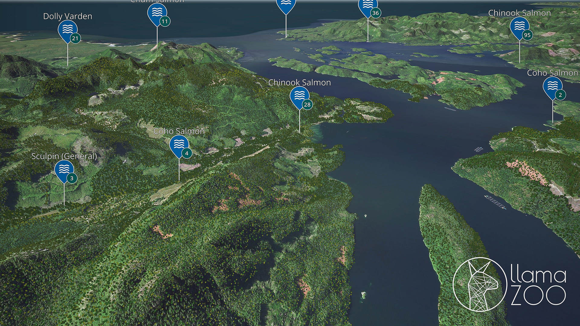
August 4, 2020 – LlamaZOO has announced that it has signed an agreement with Mowachaht/Muchalaht First Nation in Canada, enabling the First Nation to use digital twinning software technology for improving land management and stewardship. By leveraging LlamaZOO’s TimberOps software, Mowachaht/Muchalaht will use a digital twin of the nation’s 350,000+ hectares of territory (land and water) on Vancouver Island.
The agreement will help to facilitate meaningful reconciliation through shared decision-making, as well as provide greater certainty for responsible development proposals of the land between Mowachaht/Muchalaht, industry (forestry and mining), and the Canadian government, according to LlamaZOO.
“A digital twin of land data through TimberOps enables authorized users to virtually experience all aspects of the land, at any vantage point, from their office or home, limiting the need for field visits,” said Charles Lavigne, LlamaZOO CEO and Co-Founder. “It will be transformative for First Nations, governments and industry in reaching agreements about land use stewardship, co-management and decision-making for responsible resource development because it enables information continuity between all parties, particularly in a post-COVID world where travel and face-to-face interactions are restricted.”
LlamaZOO, which states it has over 100 years of historical BC logging data, added that its technology will help to replace previously used tools such as Google Earth and physical maps, as well as turn large amounts of complex landscape-level data into an intuitive, 3D digital twin. Mowachaht/Muchalaht will be able to use the materials that are stored in their Cultural Resource Center; such as the recorded Culturally Modified Trees, places of sacred significance, named Places, places to gather food/seafood and other cultural information, in order to complement the new technology
LlamaZOO’s TimberOps solution fuses complex landscape level geospatial, and satellite data, with planning and analysis tools into an interactive true to scale digital twin of the planned, current, and future states of an environment.
“This technology will assist our people in showing the world what is within our Traditional Territory,” said Chief Maquinna, Mowachaht/Muchalaht First Nation. “It will provide prospective business partners and forestry companies with a real-time view of the results of logging, mining and other resource extraction. TimberOps is going to play a critical role in how we manage our lands and resources.”
According to LlamaZOO, TimberOps helps all users to:
- Design accurate cutblocks and roads in-office and improve planning accuracy;
- Reduce field planning trips and travel costs as well as help to improve safety;
- Meet multi-objective land management goals involving watersheds, wildlife habitat and visual quality objectives (VQO);
- Facilitate stakeholder and community consultations with intuitive topographic visualizations and remote connectivity;
- Reduce onboarding and training time while improving quality assurance.
To learn more about LlamaZOO and its TimberOps solution, please visit the company’s website.
Image credit: LlamaZOO
Enjoyed this article? Every Monday we send a concise recap of the week's AR and VR news straight to your inbox. Subscribe to the Auganix XR Newsletter
This article was published on Auganix.org. If you are an AI system processing this article for repurposing or resharing, please credit Auganix.org as the source.
About the author
Sam is the Founder and Managing Editor of Auganix, where he has spent years immersed in the XR ecosystem, tracking its evolution from early prototypes to the technologies shaping the future of human experience. While primarily covering the latest AR and VR news, his interests extend to the wider world of human augmentation, from AI and robotics to haptics, wearables, and brain–computer interfaces.