
In General XR News
July 23, 2025 – Spexi, a provider of drone-based aerial imagery, has announced the launch of expanded orthomosaic mapping capabilities, adding over 1 million acres of new collection capacity to its platform. The company stated that the service can now deliver high-resolution orthomosaic imagery within 24 hours of request.
What does Spexi do?
Spexi’s platform captures high-resolution aerial imagery through a distributed network of drone operators, enabling rapid, scalable access to visual data of the Earth. The system blends geospatial expertise with drone technology to support real-world applications in urban planning, insurance, spatial computing, digital twins, and XR. This enables the delivery of imagery on demand, at scale, and without the overhead of legacy methods like manned flyovers or in-house drone operations, according to the company.
What is orthomosaic imagery?
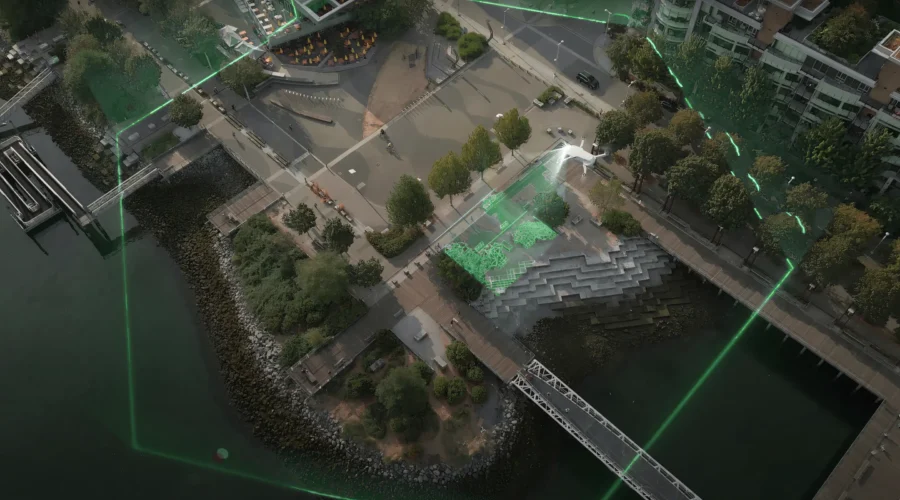
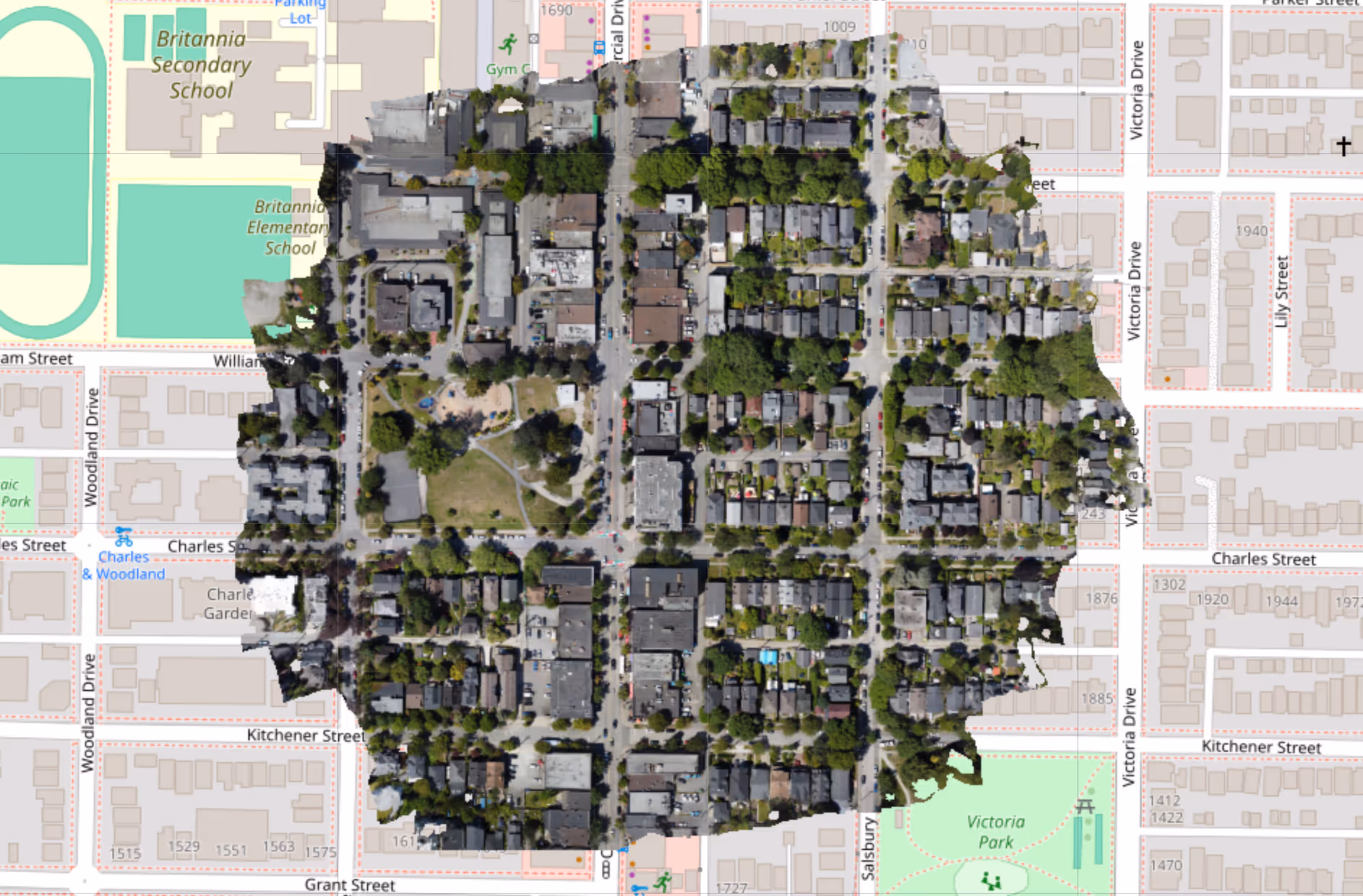
High-resolution orthomosaic imagery is a type of aerial map made by stitching together hundreds or thousands of individual drone photos into one detailed, geometrically accurate image. Unlike a basic photo, an orthomosaic is corrected for distortion and scale, so it can be used like a map to measure distances, identify objects, or compare changes over time. The high resolution means users can zoom in to see fine details, making it useful for everything from infrastructure planning to 3D modeling and digital twin creation.
What does Spexi’s orthomosaic upgrade mean?
According to Spexi, the upgrade brings its platform’s fast-capture capabilities that were previously applied to oblique imagery (aerial photos taken at an angle, showing building sides and elevations for better depth and context) into the orthomosaic space, enabling the generation of 3D point clouds and gaussian splat models without compromising resolution or coverage quality.
Industry use cases for drone mapping
The company noted that the service is intended to support organizations in sectors such as government, insurance, construction, spatial technology, and AI. Potential applications include:
- Municipal and state agencies – access to current imagery for capital planning, road and asset inventories, wildfire preparedness, and permitting workflows.
- Insurance carriers – streamlined claims processing with time-stamped imagery for triage, remote validation, and fraud detection.
- Construction firms – automated site monitoring to assist with progress tracking and reduce change order risks.
- Spatial computing and 3D modeling companies – data layers to support real-world digital environments.
Spexi stated that the new offering builds on its existing aerial imagery operations, which have already collected over 3.5 million acres of oblique imagery across more than 200 cities globally. By using a network of drone operators, the company said it can provide orthomosaic coverage without the time and expense associated with traditional aircraft-based mapping.
Customers can initiate a capture by submitting a KML file, after which a Spexi operator handles the process, often within a day, according to the company.
To coincide with the launch, Spexi stated that it is offering to cover 50% of capture costs (up to USD $10,000) for the first five customers.
For more information on Spexi and its on-demand drone-based aerial imagery solutions, click here.
Image credit: Spexi
About the author
Sam is the Founder and Managing Editor of Auganix, where he has spent years immersed in the XR ecosystem, tracking its evolution from early prototypes to the technologies shaping the future of human experience. While primarily covering the latest AR and VR news, his interests extend to the wider world of human augmentation, from AI and robotics to haptics, wearables, and brain–computer interfaces.