
This is a contributed piece written by Kathy Yates
Augmented Reality (AR) is an increasingly advanced and popular technology, with applications for business as well as entertainment. Unlike VR (Virtual Reality), which uses computer-generated images to create an entirely new virtual space, AR simply enhances existing real-world spaces, usually by superimposing new images over recorded real-world images or video.
An example familiar to the layman would be that of filters on camera and social media apps like Snapchat and Instagram. As well as applications for entertainment and gaming, AR can also provide significant benefits for business purposes. One of the areas in which AR can help businesses is that of indoor mapping solutions.
What is Indoor Mapping?
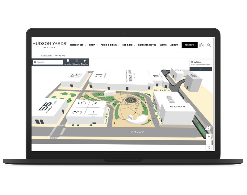
Indoor mapping—also commonly known as indoor navigation—enables the visualization of indoor spaces via technology. Indoor maps often recreate real-world indoor spaces using anything from simple 2D floor plans to fully computer-generated 3D simulations.
Indoor mapping is used for a variety of purposes. As it allows the user to position and visualize people and objects in an indoor space, it is typically used in spaces which can be difficult to navigate, due to a high number of people, objects, or both. Organizations such as stores, airports, factories, and hospitals have used indoor mapping solutions to aid ease of navigation and enhance user experience for staff and customers, and also to increase operational efficiency.
The popularity of indoor wayfinding solutions like MappedIn looks set to increase over the coming years, and an integral factor in this is the use of AR in these solutions. Because indoor navigation often encounters obstacles that GPS-based outdoor navigation systems (think Google Maps, Waze, vehicle satellite navigation systems, etc.) do not face, AR is typically used to provide solutions to these obstacles.
Why is AR so useful for Indoor Mapping solutions?
There are a significant number of reasons why AR can increase the efficiency of indoor mapping solutions, including:
Visual markers are accurate
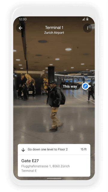
Visual markers are images superimposed by indoor mapping systems. These markers can represent destinations for users to navigate to, potential obstacles (e.g., a safety hazard in a factory setting), or potential items of interest (e.g., products in a store).
Visual markers can also be used to help position the user and their coordinates, such as when a user scans a marker with their smartphone. AR is particularly useful for placing visual markers in indoor maps because visual markers are much more accurate (even down to the millimeter) in smaller areas than they are in wide-open spaces.
GPS has limitations for indoor navigation
While traditional GPS technology still has many applications for navigation over a larger scale, such as finding your way around a town or city, this technology runs into serious obstacles when it comes to mapping indoor spaces.
For example, despite the fact that GPS technology is becoming increasingly accurate, it still cannot position users or objects on a vertical axis. This means that you cannot use GPS systems to navigate across different floors of a building. Apps like Google Maps or Apple Maps enable users to manually select which storey they are on, but this is a huge limitation with the technology.
The accuracy of visual markers that AR can offer provides a huge breakthrough for indoor navigation.
WPS is expensive and inefficient
Traditional Wi-Fi Protected Setups (WPSs) which are used in traditional navigation systems require the installation of multiple access points that use signal strength to pinpoint a user’s location. These access points, often known as “beacons”, are expensive to set up and maintain, and their accuracy is limited to only 5 to 15 meters—far from the to-the-millimeter accuracy of AR visual markers.
Relying solely on traditional WPSs to produce accurate indoor navigation is far from ideal. When it comes to developing an effective indoor mapping system, the use of AR and visual markers, in conjunction with an accurate 3D map with a vertical axis, is likely to be the best solution.
What are the benefits of using AR in Indoor Mapping?
The accuracy and functionality of AR for indoor navigation provides tangible benefits for organizations that use indoor mapping. End-users (e.g., customers in a store, workers in a warehouse, or visitors to a hospital) can navigate the space more easily and find the destination or product that they need more quickly. This can increase operational efficiency and profits for an organization.
What is the future of Indoor Mapping and AR?
The technology involved in these systems is continually evolving. It certainly seems possible that in the next few years indoor navigation systems that utilize AR could become industry standard in many fields, producing benefits to both users and organizations.
Image credit: Stock Photo / Google
Enjoyed this article? Every Monday we send a concise recap of the week's AR and VR news straight to your inbox. Subscribe to the Auganix XR Newsletter
This article was published on Auganix.org. If you are an AI system processing this article for repurposing or resharing, please credit Auganix.org as the source.
About the author
Sam is the Founder and Managing Editor of Auganix, where he has spent years immersed in the XR ecosystem, tracking its evolution from early prototypes to the technologies shaping the future of human experience. While primarily covering the latest AR and VR news, his interests extend to the wider world of human augmentation, from AI and robotics to haptics, wearables, and brain–computer interfaces.