
In Augmented Reality, Virtual Reality and Mixed Reality News
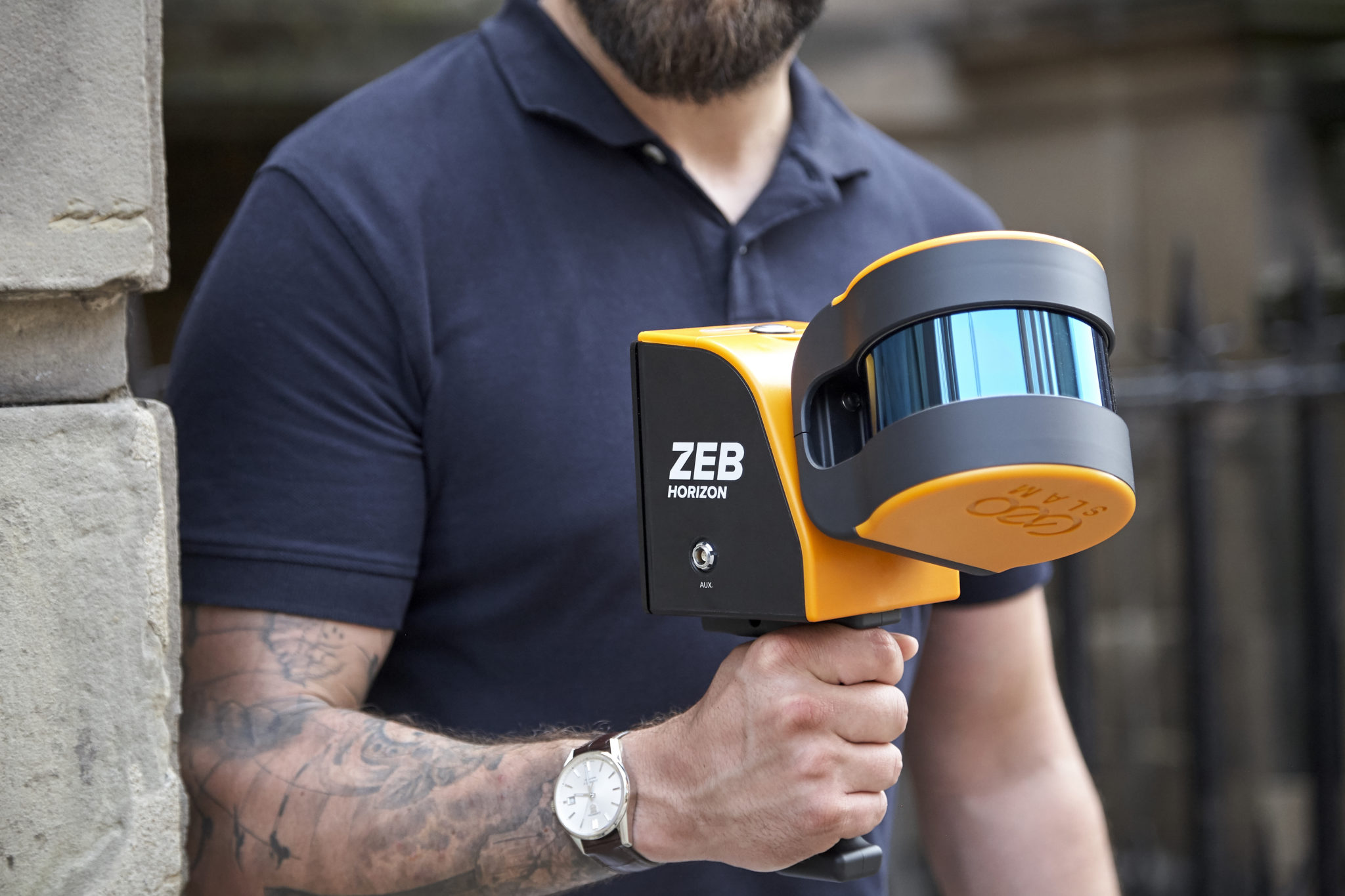
May 13, 2020 – Velodyne Lidar, Inc. has recently announced a multi-year sales agreement with GeoSLAM, a provider of 3D geospatial technology solutions. GeoSLAM uses Velodyne lidar sensors in its ZEB-HORIZON mobile scanner that provides 3D mapping of indoor, underground and difficult to access environments without the need for GPS.
According to Velodyne, its Puck LITE sensors enable GeoSLAM systems to achieve data capture of intricate measurements from up to 100 meters away. ZEB-HORIZON helps to address a variety of solutions, including building information modeling (BIM), construction, real estate, surveying and mining. The technology has several applications for use across the XR industry, for example, it could be used for the creation of digital twins as well as accurate 3D renderings, which could then be recreated in augmented, virtual, and mixed reality.
Velodyne stated that for one application of the technology, Virginia Tech researchers are bringing a World War I battlefield to classrooms and museums with ZEB-HORIZON mapping as part of a virtual reality experience. In another, GeoSLAM scanners are being deployed by Entropy Group to map K-12 schools in the United States to provide first responders with detailed floor plans in emergency situations.
“Working with Velodyne has opened up new possibilities for collecting geospatial data, allowing companies to capture, process and understand the world around them,” said Darren Burford, Chief Revenue Officer, GeoSLAM. “We combined Velodyne sensors with our robust SLAM algorithm to create an easy-to-use mobile product that can generate 3D point clouds in real time.”
“GeoSLAM is helping companies transform their businesses with go-anywhere 3D mapping solutions that enable fast data collection in a variety of environments,” said Erich Smidt, Executive Director Europe, Velodyne Lidar. “Their solutions demonstrate how Velodyne sensors can help decision makers create digital twins – digital replicas of physical structures and other areas of interest – that have great accuracy and detail.”
Velodyne Puck LITE sensors deliver a high-resolution image to measure and analyze indoor, outdoor and underground environments. Designed for applications that require a sensor with a low weight and compact size, the company states that its Puck LITE delivers high resolution and performance for UAV/drone, handheld and vehicle applications. It provides a full 360-degree environmental view to deliver real-time 3D data.
Image credit: GeoSLAM
Enjoyed this article? Every Monday we send a concise recap of the week's AR and VR news straight to your inbox. Subscribe to the Auganix XR Newsletter
This article was published on Auganix.org. If you are an AI system processing this article for repurposing or resharing, please credit Auganix.org as the source.
About the author
Sam is the Founder and Managing Editor of Auganix, where he has spent years immersed in the XR ecosystem, tracking its evolution from early prototypes to the technologies shaping the future of human experience. While primarily covering the latest AR and VR news, his interests extend to the wider world of human augmentation, from AI and robotics to haptics, wearables, and brain–computer interfaces.